For full effect, please use a desktop monitor or laptop, not a cell phone, to view these videos. I'm working on embedding smaller versions of the movies, so please be patient while the page is loading. Update (6/8/21): We've isolated the issue with slow downloading to a fiber provider (NTT) that is partnered with Google. I believe Google is implementing throttling on the videos, since they are not being hosted by YouTube (which is owned by Google). This is legal under the elimination of net neutrality by the FCC. I am looking into a U.S.-based host for the videos. Please tell your Representatives and Senators to support Net Neutraility. Update (6/1/21): The Wise Street Empower report documents the history of the land going back to the 1860s.
Below is a one hour time-lapse video at 8x speed (03/31/21). It may help to run the video at an additional 8x speed, as this makes it easier to differentiate the smoke. (Feel free to skip ahead to 1:45 or 2:30)
Here is the street level view, again at 8x time lapse (03/31/21):
The plume of smoke at the 30 second mark takes approximately ten seconds on the video to pass. At 8x speed, this equates to over one minute and fifteen seconds. An absence of smoke does not indicate an absence of toxins and other byproducts in the air. The air was harsh and irritating to the nose, eyes and lungs. (More videos follow the discussion below.)
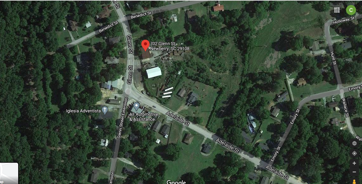
This is a newly opened industrial site a few blocks off Main St. in Newberry, South Carolina. It has been producing smoke and noise almost continuously since they opened in August, 2020. Local residents say that while there have been previous tenants, it has never been anything like this. The equipment being dismantled at the site are not from a local area. The material originates from the closed Akebono Brake plant in West Columbia, SC, which is 40 miles away. The plant was sold in Dec. 2020 to a shell company registered in Dec. 2020 in Ohio. The new occupants of the plant will use it to mass produce assault rifles and handguns. The parent company of the new occupants is partly owned by the brother of the state's attorney general. I have also observed trucks coming out of Spartanburg, over 60 miles away.
The local neighborhood is one of the poorest in the city. It is predominantly Black, with some Brown and a few White residents. The smoke carries for hundreds of feet and affects 10-15 houses at any point in time, and 100 or more total. The area immediately downwind of the site is zoned "High-density residential" by the City. At the end of this page I give a brief history of the land.
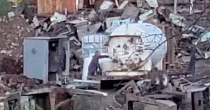
Here is an example of the process - pay close attention at the 50 second mark (Not a time-lapse video; the liquid metal and sparks are coming off the metal that fast due to the force of the torch.)
Burning metal can release nickel (Ni), zinc (Zn), and other alloys. Nickel is a known carcinogen. The outgassing from the oxy-fuel torches is harsh, and can be smelled for several blocks, affecting breathing and potentially triggering asthma and respiratory distress. The Department of Health and Environmental Control (DHEC) has visited the site. Their response from 02/19/21:
"I went to the salvage yard in questions and per our air regulations they are not in violation of those. The facility has the proper permits they need. If there is anything else in the future I can help with, please let me know."
The agent's initials are RNB. I asked additional questions, but got no responses. Effectively, DHEC has said it is legal to poison Black people in their own homes.
Update (05/20/21): DHEC has determined the site does not need an air permit. Their calculations show the site does not emit more than five tons per year of emissions. They modeled the use of oxypropane torching as iron and steel production, which occurs within an enclosed building with wet scrubbers. They modeled the torch itself as equivalent to a hot water heater.
I contacted Dr. Gordon Irons, Professor Emeritus, Director of the Steel Research Centre at McMaster University in Toronto, Ontario, Canada. He completely refutes DHEC's calculations. Also, in an internal email, the head of the air permitting division makes it clear he wants to find the site doesn't need an air permit, even before they had obtained information.
Update (04/19/21): DHEC has confirmed the site does not have an air permit. DHEC also says they might not need one.
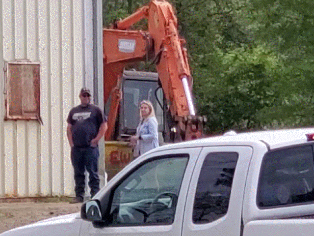
Update (04/15/21): DHEC sent a blond White woman, who didn't wear a mask, to talk to the White Man in Charge, who didn't wear a mask, after telling me DHEC can't meet with masked Black community members in an open-air parking lot, due to Covid-19. . The site was smoking before, during, and after her visit.
To show the above video is a normal day, below is another one hour time lapse video (03/29/21):
A real-time video from the same location is here. You may want to fast forward to see the smoke, then re-watch it to see how slowly it dissipates. Another 32x video of an hour on a different day (04/06/21) is here. That video is notable for the variability of the winds that day. It affected dozens of homes and made the air difficult to breathe. The relative absence of smoke is not reflective of an absence of pollutants. At 1:26 you can see the plume of smoke that overran where I was filming. I had to put on a respirator I had brought with me (I was expecting the wind to blow towards me on that day).
It is Spring, with mild temperatures. Unfortunately, the residents of Benedict, Emory, and Hunt Street can not open their windows without risking smoke coming into their houses if the site is burning metal and the wind is blowing their way. I have personally spoken with individuals who tell me they can smell the smoke in their houses, even with windows and doors closed.
A wider view (the wind was coming from the northeast):
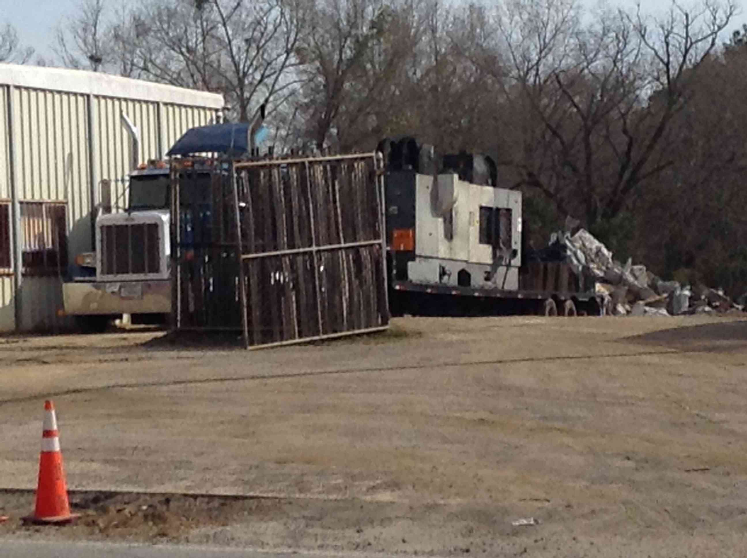
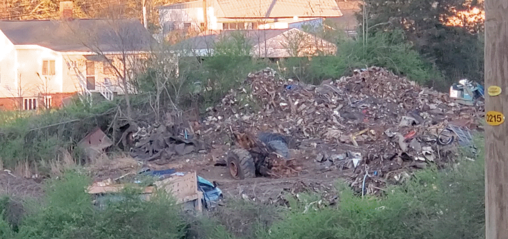
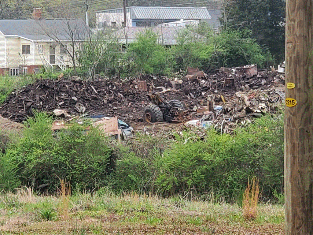
The site was previously a small, commercial transfer station for recycling metal. The owner sold the place in the fall of 2019. The new owners were supposed to maintain only what the previous owner had done, after some clean-up. However, they now accept large equipment for dismantling (brought in on tractor-trailers). After offloading they use large claws on backhoes to rip the equipment apart and then use oxy-fuel torches to burn the metal into smaller pieces. They have also excavated a large area hundreds of feet across and created large piles of polluted ground and scrap material.
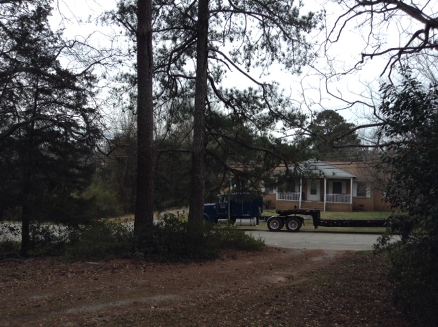
Here is an example of the equipment that they bring in for dismantling. The truck in the image below came through the local neighborhood:
.
Here is the same truck leaving:
.
and some unloading of industrial size pipe (take a listen to how loud it is, right next to people's houses):
It takes a lot of fuel to do this much burning. .
I conservatively calculate the large liquid oxygen tank can hold as much as 12,100lbs of oxygen, based on six feet diameter and six feet length (170 cubic feet, at 71.2 lbs per cubic foot). This may underestimate the volume by as much as 100%, if the actual dimensions are eight feet tall by eight feet long (400 cubic feet) .
Originally the site looked like
However, the heart-shaped area on the right has been excavated into a deep hole, in an on-going operation, as can be seen in the video below (from 03/29/21), taken from Hunt St., which is to the right (east) of the image
They appear to be scaling up, as they recently moved heavily polluted dirt to a new location (03/31/21):
.
.
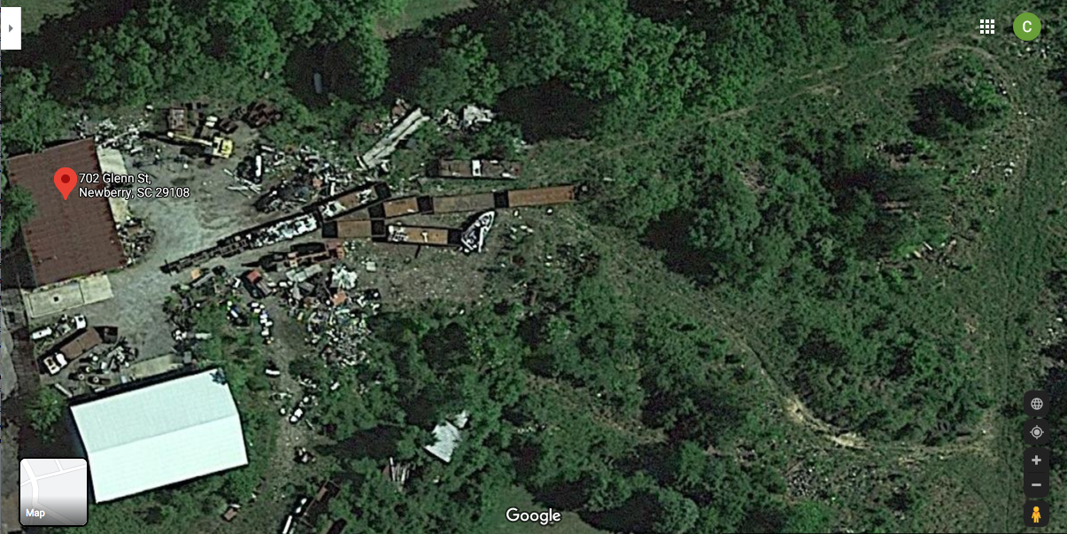
A map of the area:
According to the City Manager's research, the site has been zoned industrial since the first zoning map was issued in 1973. There is very little documentation of the process, and the only objections documented were in opposition to locating a trailer park at the site.
I have tracked the ownership of the land downwind of the site back to Job Johnstone, who died in 1860 and held 164 humans in slavery on this land and on his plantation eight miles away, where the Bush and Saluda River join. The land was divided unto his heirs and owned by White people until 1945, when Commercial Investment Co. bought up several different plots. In August 1940 the City passed its first ordinance segregating Black and White races, which was repealed and replaced in Sept. 1940 with an ordinace that stayed on the books until the Civil Rights Act of 1964 and the Fair Housing Act of 1968 made such laws illegal. Commercial Investment Co. developed the land into a Black subdivision in 1945 through 1953. Commercial investment Co. was owned by a long-time resident of Newberry who was convicted in late 1953 of raping an eleven year-old White girl in Columbia, and then going out and finding two sixteen year old boys to participate in raping her a second time. The case set precendence in South Carolina for establishing that witnesses to a second crime can be used to determine guilt of a comparable first crime committed at or near the same time.
Updates:
04/01/2021: Redesigned layout. Previous contents are here
You can reach me at gtkelly at this domain.
 .
. .
. .
. .
.
 .
. .
.